1. Geographical location, climate and weather characteristics;
a) Geographical location:
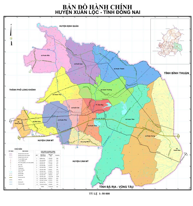
- Xuan Loc district is located in the Southeast of Dong Nai province, the district was established on July 1, 1991. In early 2004, implementing Decree 97/2003/ND-CP dated August 21, 2003 of the Government "On the re-establishment of Long Khanh town and the establishment of 2 new districts Cam My and Trang Bom", Xuan Loc district continued to adjust its administrative boundaries, the district handed over 6 communes to Cam My district. Currently, the total natural area of the district is 727.19 km2 , ranking fourth in the province in terms of natural area and accounting for 12.34% of the natural area of Dong Nai province.
b) Administrative boundaries:
+ Bordering Dinh Quan District to the North.
+ Bordering Cam My District and Ba Ria Vung Tau Province to the South.
+ Bordering Binh Thuan Province to the East.
+ Bordering Long Khanh Town to the West.
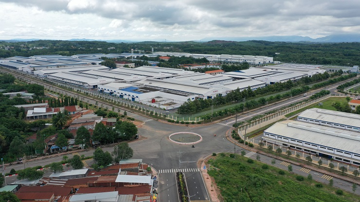
- Xuan Loc District consists of 15 administrative units, including Gia Ray Town and 14 communes with a total of 91 hamlets and villages. As a famous place in the historic Ho Chi Minh campaign in 1975, Xuan Loc has the advantage of being the gateway to the Southeast region and Ho Chi Minh City located along National Highway 1A, 47 km long; there is a 33 km North-South railway passing through with 3 small stations; 3 Provincial Roads 763, 765, 766. The district center is located at Ong Don intersection, which is the hub of important traffic routes in the region, giving Xuan Loc an advantage and developing an outward-oriented economy with strengths in agriculture, services, and industry, while playing an important role in the economic development of Dong Nai province and expanding the exchange between Dong Nai and the provinces of the South Central Coast and Ba Ria - Vung Tau province.
c) Terrain:
The terrain of Xuan Loc has two main types of terrain: mountains and gently undulating hills. - Mountain terrain: Scattered into independent mountains with large slopes, accounting for about 6-7% of the total area of the district, the largest of which is Chua Chan mountain with an altitude of 844 m, this is a potential tourist destination of the district, especially after being recognized as a national historical relic. In addition, there are other small mountains such as: SaBi mountain, Ba Sot mountain, Hoa Hung mountain, .... - Gently undulating hills: Is the main terrain type, currently accounting for about 85% of the total area of the district. The common slope is from 3 to 8 0. Quite favorable for agricultural development with famous annual and perennial crops of the district such as: hybrid corn; durian, rambutan, mango, ...
d) Weather and climate:
- Xuan Loc district is located in the equatorial tropical monsoon climate zone, with the following characteristics:
+ Abundant radiation energy with high and stable temperature, average 154 - 158 Kcal/cm2 -year . Lots of sunshine (average 5.7 - 6 hours/day), high and even temperature throughout the year (average 25.4 0 C); total large heat accumulation averages 9,271 0 C/year. Xuan Loc is almost unaffected by natural disasters such as storms and floods, very favorable for socio-economic development.
+ Temperature: varies by season and region, relative humidity 72 - 80%, highest 83 - 87% and lowest 55 - 62%.
+ Rainfall: Xuan Loc has a relatively high rainfall compared to other districts in the province. The rainy season starts in May and ends around the end of November. The most obvious limitation in the rainfall regime here is that there are often short droughts at the beginning of the Summer-Autumn crop. The heaviest rainfall in the year is around July to September, combined with high humidity. The average annual rainfall is 1,956 mm, the highest is 2,139 mm and the lowest is 1,150 mm. The average number of rainy days in the year is 98 days. The highest rainfall in a day is 138 mm.
+ Sunshine regime: usually from November of this year to May of the following year, the average sunshine time per day is 5.7 - 7.4 hours. The highest sunshine hours per day is 13.8 hours and the lowest is 0.5 hours. The highest illumination intensity is 100,000 Lux. The dry season usually starts from December to April.
+ Wind regime: the main wind direction is southeast (February, May) with an average wind speed of 3 - 3.5 m/s, the maximum speed is 10.9 m/s. North - northeast (December, January) with an average wind speed of 3.4 - 4.7 m/s, the maximum speed is 6 m/s.
In general, the climate and weather of the District are favorable for agricultural development, with few natural disasters such as storms, floods, frost, etc.
2. Land and usage structure:
According to the statistics of land use status as of January 1, 2010 of the Department of Natural Resources and Environment, Xuan Loc district has a natural land area of 72,719.48 ha, with 57,411.85 ha of agricultural land accounting for 78.95%, of which: annual crop land is 12,628.43 ha, accounting for 22.0% of agricultural land. Of the annual crop land, 48.5% of the area is land for growing color - short-term industrial crops distributed mainly on brown soils on Bazan and gray-yellow granite with small slopes and medium thick layers. Rice land accounts for 51.5% of the annual crop land area, of which about 70% is single-crop rice land.
Perennial crop land: 34,852 ha, accounting for 60.71% of the agricultural land area, of which: 55.97% is land for growing perennial industrial crops; 14.64% is land for growing fruit trees, the rest is land for other perennial crops, accounting for about 29.38% of perennial land.
3. Water source:
- Xuan Loc has a relatively high density of rivers and streams, but most of them are short and steep, so their water retention capacity is poor and they are depleted in the dry season. The construction of reservoirs combined with the transfer of water from outside the region is very necessary for economic and social development, especially for the development of agricultural and industrial production in the district, with the main river and stream systems such as:
+ La Nga River: originates from the high mountains of Binh Thuan and Lam Dong provinces. Basin area: 4,100 km 2 , flow module is quite good (38.41/s/km 2 ), average flow: 113 m 3 /s, dry flow: 3.5 - 4 m 3 /s. The main river is about 290km long, the section flowing through Xuan Loc District is 18 km long, with a basin area of about 262km 2 . The streams of La Nga River in Xuan Loc district include: Gia Huynh stream, Cao stream, Ret stream, Gia Ray stream. The streams with water all year round are Gia Huynh, Ret stream.
+ Ray River: originates from the southern and southwestern areas of Chua Chan mountain, the basin area within the district is 458.92 km 2 , with main branches such as: Mon Coum stream, Cat stream, Sap stream, .... The main river is 60 km long, the section flowing through Xuan Loc district is 15-20 km long.
+ River branches of the Dinh river system: originate from the southeastern area of Chua Chan mountain, the basin area is 227 km 2 including Gia Ui stream, Da stream, Cong Hoi stream, DaKrie stream, due to the narrow basin, poor cover, long dry season, these streams often dry up at the end of the dry season.
Xuan Loc district is located in an area with poor groundwater. On red-yellow soil, groundwater usually appears at a depth of 25 - 30m, in other areas, groundwater usually appears at a depth of 80 - 102m, with an average flow rate of 0.5 to 1.2l/s, and good quality. Currently, groundwater is being exploited for domestic use and irrigation of crops.
4. Forest resources:
According to the land inventory data in 2010 of the Department of Natural Resources and Environment, the whole district has about 9,383 hectares of forest, including:
- Production forest: 4,389 hectares, all of which are planted production forests with low timber reserves.
- Protection forest: 4,994 hectares, distributed in the Chua Chan mountain area and the communes of Xuan Thanh, Xuan Truong, Xuan Hoa, Xuan Hung and Xuan Tam.
5. Information about communes and towns
| STT |
Administrative unit |
Natural area (ha) |
Defense land area (ha) |
Average population in 2012 (people) |
|
| |
| 1 |
Gia Ray Town |
1.396,99 |
93 |
16.937 |
|
| 2 |
Xuan Bac Commune |
6.315,89 |
|
18.357 |
|
| 3 |
Xuan Thanh Commune |
6.834,14 |
7 |
9.826 |
|
| 4 |
Xuan Truong Commune |
4.720,42 |
308,01 |
18.539 |
|
| 5 |
Suoi Cao Commune |
5.410,73 |
|
9.097 |
|
| 6 |
Xuan Tho Commune |
3.775,69 |
|
18.788 |
|
| 7 |
Xuan Tam Commune |
12.192,81 |
4.540,26 |
26.812 |
|
| 8 |
Lang Minh Commune |
1.712,33 |
|
8.495 |
|
| 9 |
Xuan Hiep Commune |
2.443,68 |
44,76 |
15.282 |
|
| 10 |
Suoi Cat Commune |
1.693,58 |
|
13.059 |
|
| 11 |
Xuan Phu Commune |
3.857,10 |
|
16.142 |
|
| 12 |
Bao Hoa Commune |
1.814,27 |
|
12.416 |
|
| 13 |
Xuan Dinh Commune |
1.332,01 |
|
8.837 |
|
| 14 |
Xuan Hoa Commune |
8.723,53 |
15,26 |
12.528 |
|
| 15 |
Xuan Hung Commune |
10.496,33 |
3.071,94 |
24.837 |
|
| Total |
72.719,48 |
8.080,23 |
229.952 |
|
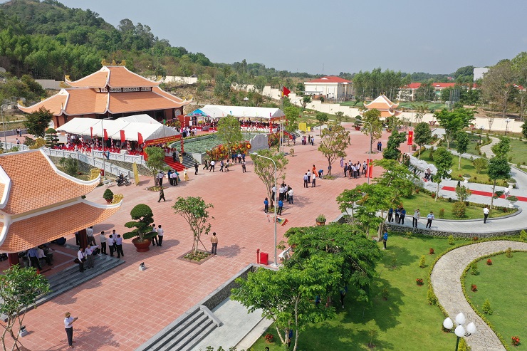
Martyrs Temple District Technology Park